
A road trip is a different proposition: you accept the driving. Where the previous itineraries stayed within an hour’s radius, this one goes after the vertigo citadels and the Minervois — and you’ll see that the numbers are what they are.
Here is the route in four stages, with real distances and the only strategic choice that matters: fixed base or moving on?
The question to settle first
| Fixed base in Castelnaudary | Moving on each night | |
| Luggage | unpacked once | repacked every day |
| Peyrepertuse | 1 hr 53 (3 hr 46 return) | 30 min from the Corbières |
| Quéribus | 1 hr 54 (3 hr 48 return) | 20 min |
| Everything else | all under 1 hr 10 | scattered |
| Evenings | restaurant on site | a new search every time |
The honest answer: fixed base for stages 1 to 3, one night on location for stage 4 if the citadels matter to you.
Because of the four stages of this road trip, three are less than 55 minutes from the Clos Fleuri. Only the last one justifies moving.
Stage 1 — Castelnaudary and the Lauragais
17-minute radius · ~40 km
The starting point, and the only place where you won’t be driving.
The Grand Bassin (1.9 km, 3 min): 7 hectares, the largest stretch of water on the Canal du Midi, dug by Riquet as a winter harbour and turning basin.
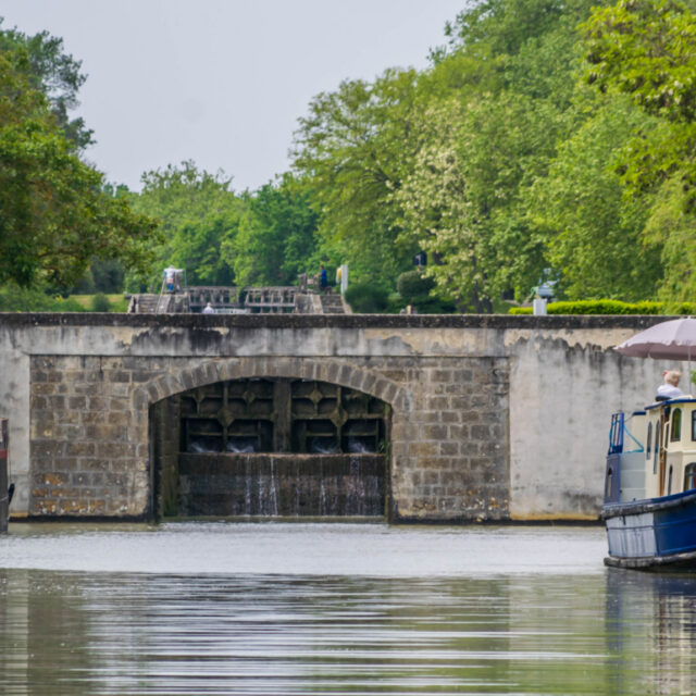
The Saint-Roch locks (1.7 km, 3 min): four chambers, about ten metres. The chambers are oval — Riquet curved the walls so that the pressure of the earth works in compression, like an arch. That’s why they’ve held for 350 years, and it’s one of the reasons for the UNESCO listing in 1996.
The Cugarel windmill (2.2 km, 5 min): the last of the thirty-odd mills of the Lauragais, and the only point from which you can see the whole geography of the area.
The Naurouze watershed (15.3 km, 17 min): the point where the waters divide, at 189 metres. On one side the Atlantic, on the other the Mediterranean. It’s the key to the entire road trip: this line explains why you’ll cross four wine appellations and two climates in 130 km.
Saint-Papoul abbey (8.6 km, 10 min): a cathedral from 1317 to 1801, sculptures by the Master of Cabestany.
Stage 2 — Carcassonne and the Cabardès
43.7 km · 34 min
Carcassonne, the site of the crusade. August 1209: Trencavel surrenders after a two-week siege, dies in captivity at 24, Montfort takes the viscounty. 3 km of ramparts, 52 towers, UNESCO 1997.
Leave at 8:15 a.m. By 9 the ramparts are empty.
Then the Cabardès, on the foothills of the Montagne Noire. The only AOC in France allowed to blend Atlantic grapes (merlot, cabernet) with Mediterranean ones (syrah, grenache) — because it sits right on the climatic seam of Naurouze. Domaine de Cabrol in Aragon (~40 min), Cave des Oliviers in Montolieu (~34 min), Les Vignerons de la Voie Romaine in Pezens (~30 min).
Stage 3 — Saissac, Montolieu, Lastours
26 to 52 min · ~120 km over the day
Saissac (23.1 km, 26 min): a ruined fortress overlooking the Lauragais, a former Trencavel stronghold.
Montolieu (26.9 km, 34 min): the book village, fewer than 800 inhabitants.
Lastours (58.8 km, 52 min): four castles on a single ridge — Cabaret, Surdespine, Quertinheux, and the Régine tower. Cabaret held out against Montfort; the Régine tower was built by the victor. A steep 30-minute climb.
It’s the best spectacle-to-driving ratio of the whole road trip. If you were to keep only one stage outside Carcassonne, this would be it.
Stage 4 — The Corbières and the vertigo citadels
Peyrepertuse: 100.3 km · 1 hr 53 · Quéribus: 132.3 km · 1 hr 54
Here are the numbers, unvarnished.
From Castelnaudary, doing both in one day means nearly 4 hours of driving, plus two steep climbs on exposed limestone ridges, without a scrap of shade. You leave at 8 a.m., you get back at 8 p.m., and you’ll have spent a third of the day on mountain roads.
What they are: Peyrepertuse is a fortress 300 metres long on a ridge; Quéribus stands on a pinnacle where you can’t understand how anyone managed to build. Together with Aguilar (121.1 km, 1 hr 39), Puilaurens (86.9 km, 1 hr 35) and Termes (79.1 km, 1 hr 34), they are the five sons of Carcassonne.
And here’s what the signage doesn’t tell you: these five fortresses were fortified by the King of France after the Treaty of Corbeil (1258), to hold the border with Aragon. They postdate the crusade, they were built against an enemy who had nothing to do with Catharism, and they became useless in 1659 when the Treaty of the Pyrenees moved the border 100 km further south.
No Cathar ever set foot in them. Which is more interesting than the legend.
The three honest options:
- One night in the Corbières. You do Peyrepertuse and Quéribus at your own pace, plus Lagrasse (90.7 km, 1 hr 06) and its abbey, or Villerouge-Termenès (1 hr 17).
- One day, one castle. Leave at 8 a.m., Peyrepertuse, back by 6 p.m.
- You give up on them and do Lastours instead (52 min). Spectacular, and you still have the day ahead of you.
The Minervois alternative
Minerve: 99.9 km · 1 hr 18
If the Corbières put you off, the Minervois is shorter and historically stronger.
Minerve, 1210: after a siege, 140 Perfects refuse to recant and walk to the pyre. It is the first mass burning of the crusade — before Montségur, before all the rest. The village clings to the gorges, and it’s spectacular.
Combine it with a tasting in the Minervois (Château Tour Boisée in Laure-Minervois, ~50 min) and Trèbes (50.7 km, 36 min) with its Canal du Midi locks.
1 hr 18 against 1 hr 53. That’s an hour of driving saved, for a site at least as loaded with history.
The recommended itinerary
Days 1–3 from Castelnaudary: the Lauragais, Carcassonne and the Cabardès, Saissac–Montolieu–Lastours. Day 4: Minerve and the Minervois (1 hr 18) — or an 8 a.m. start for Peyrepertuse. Day 5 (optional): one night in the Corbières for Quéribus and Lagrasse.
The bottom line: you cover 80% of the road trip from a base less than 55 minutes away, with your bags unpacked and the Clos Fleuri restaurant in the evening — homemade cassoulet, duck from the Montagne Noire. And you only move for the 20% that genuinely deserves it.
Road tips
- Look at the driving times before the photos. That’s the rule. A site at 1 hr 53 isn’t a site at 1 hr 53: it’s 4 hours of driving.
- Don’t follow the GPS blindly. The Corbières roads are narrow and winding; some signposted access routes no longer exist.
- One major site per day, two at most. Each castle means 30 min of climbing and 1 hr 30 on site.
- Closed shoes, water, windbreaker. The ridges are exposed and there’s nothing at the top.
- In summer, climb before 11 a.m. Limestone ridges have no shade.
- Autumn is the best season: low light, empty sites, harvest, and temperatures that let you walk.